Primary tabs
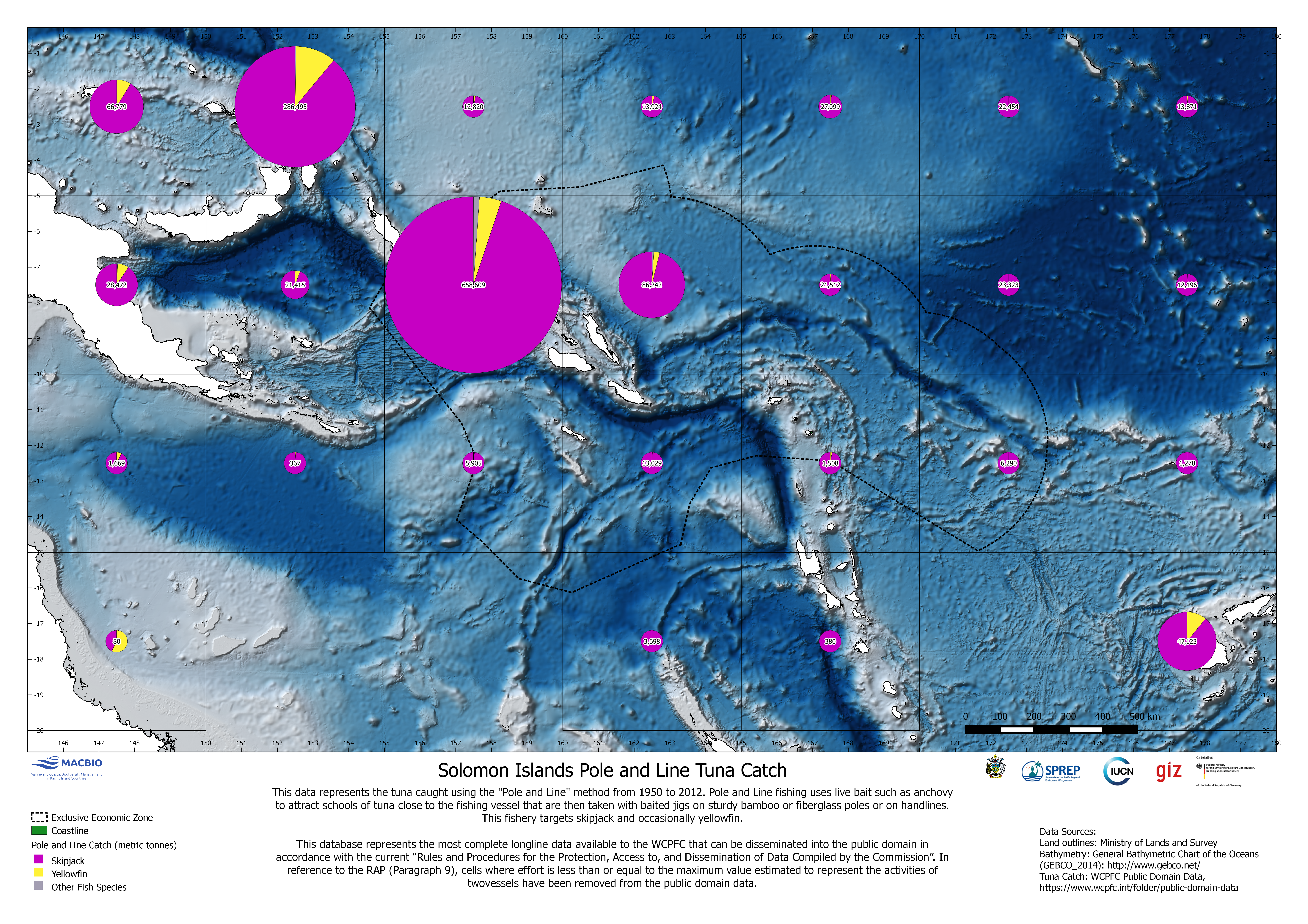
Solomon Islands Pole and Line Tuna Catch
Map showing tuna catch in metric tonnes using the "Pole and Line" method from 1950-2012. The map was developed by MACBIO as resource for the bioregions workshop in Feb 2018. Data is based on WCPFC Public Domain Data.
SI_WCPFC_PoleAndLine_EEZ.png
(26.46 MB)
Additonal Information
| Field | Value |
|---|---|
| mimetype | image/png |
| filesize | 26.46 MB |
| timestamp | Tue, 06/08/2021 - 05:06 |