Primary tabs
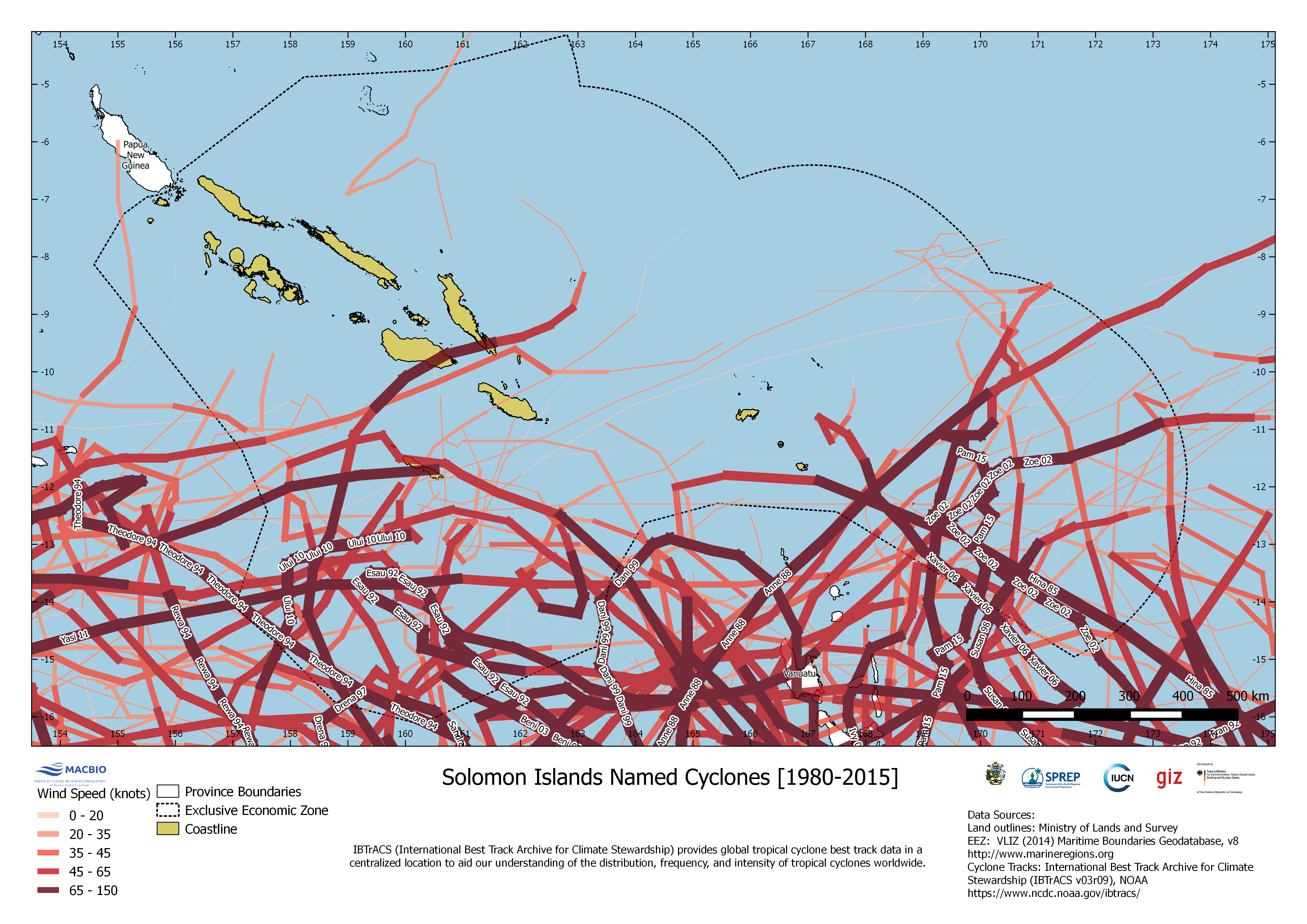
Solomon Islands Named Cyclones (1980-2015)
The map depicts paths and intensities of tropical cyclones in Solomon Islands EEZ from 1980 till 2015. Data of tropical cyclone best track data is provided by IBTrACS (International Best Track Archive for Climate Stewardship).
SI_Cyclones_EEZ.png
(2.66 MB)
Additonal Information
| Field | Value |
|---|---|
| mimetype | image/png |
| filesize | 2.66 MB |
| timestamp | Tue, 06/08/2021 - 05:06 |