Primary tabs
Solomon Islands Monitoring Sites and Datasets for Benthic Cover
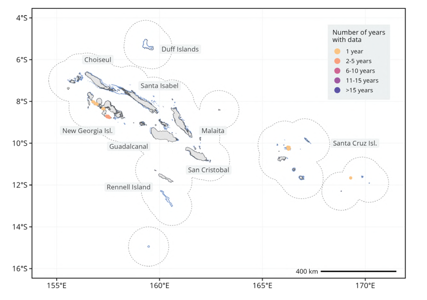
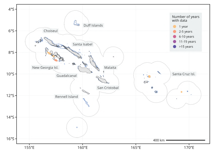
Spatio-temporal distribution of benthic cover monitoring sites across Solomon Islands. Sites that were monitored for the longest period of time are represented on top of the sites monitored for fewer years. The scale bar provides distance at the equator and may not accurately represent distance over the entire latitudinal range of the economic exclusive zone. Dashed polygons represent a 100 km buffer around coral reefs. Note that only land and coral reef buffers of the country or territory are represented, not those of adjacent countries and territories. The distribution of coral reefs is shown in light blue. (Wicquart et al., 2025)
solomon_islands_monitoring_sites.png
(207.45 KB)
Additonal Information
| Field | Value |
|---|---|
| mimetype | image/png |
| filesize | 207.45 KB |
| timestamp | Mon, 06/01/2026 - 21:50 |