Primary tabs
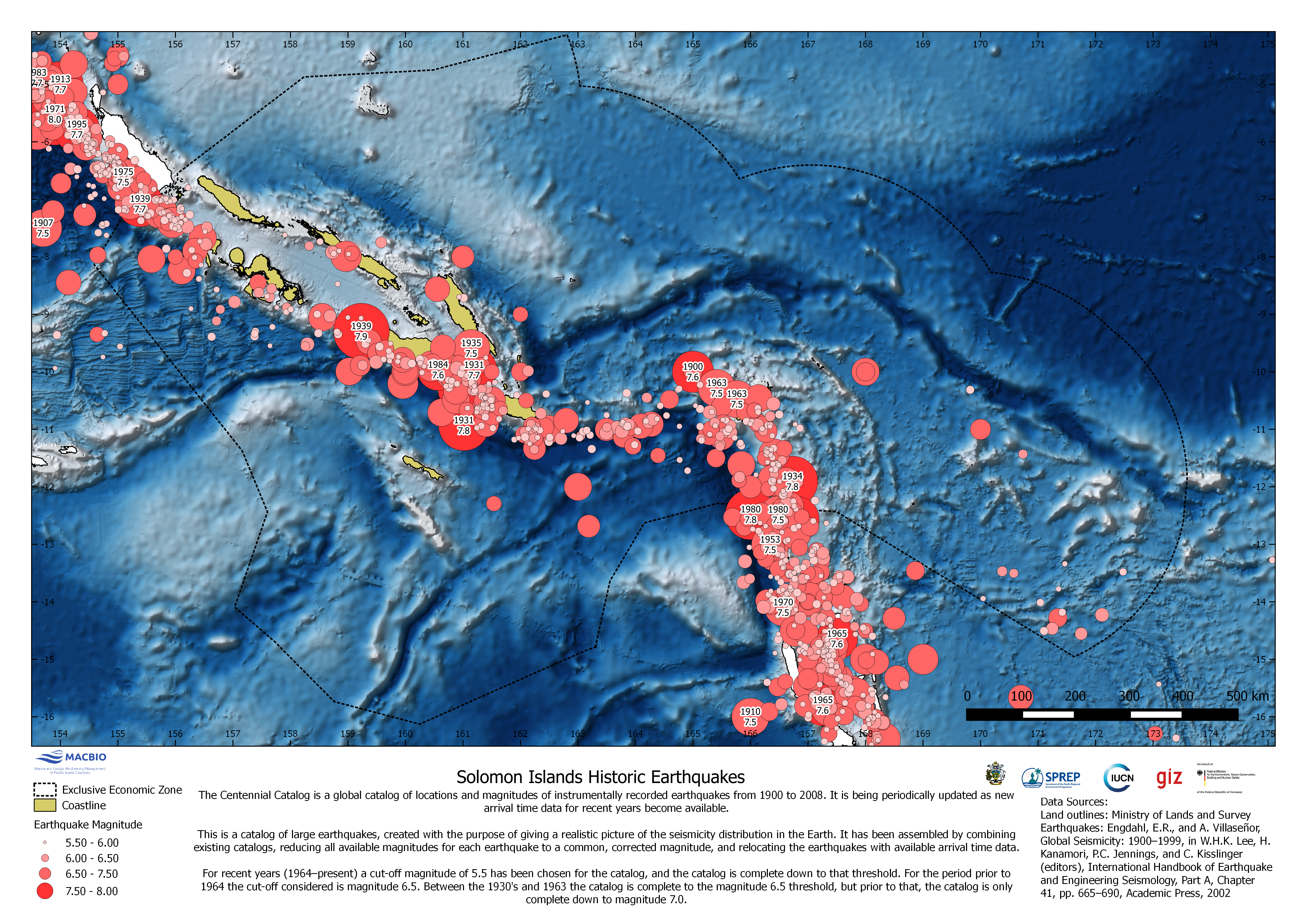
Solomon Islands Historic Earthquakes
The map shows location and magnitude of instrumentally recorded earthquakes from 1900 to 2008. Data is based on the Centennial Catalog, a global catalog of locations and magnitudes of instrumentally recorded earthquakes.
SI_Earthquakes_EEZ.png
(13.18 MB)
Additonal Information
| Field | Value |
|---|---|
| mimetype | image/png |
| filesize | 13.18 MB |
| timestamp | Tue, 06/08/2021 - 05:06 |