Primary tabs
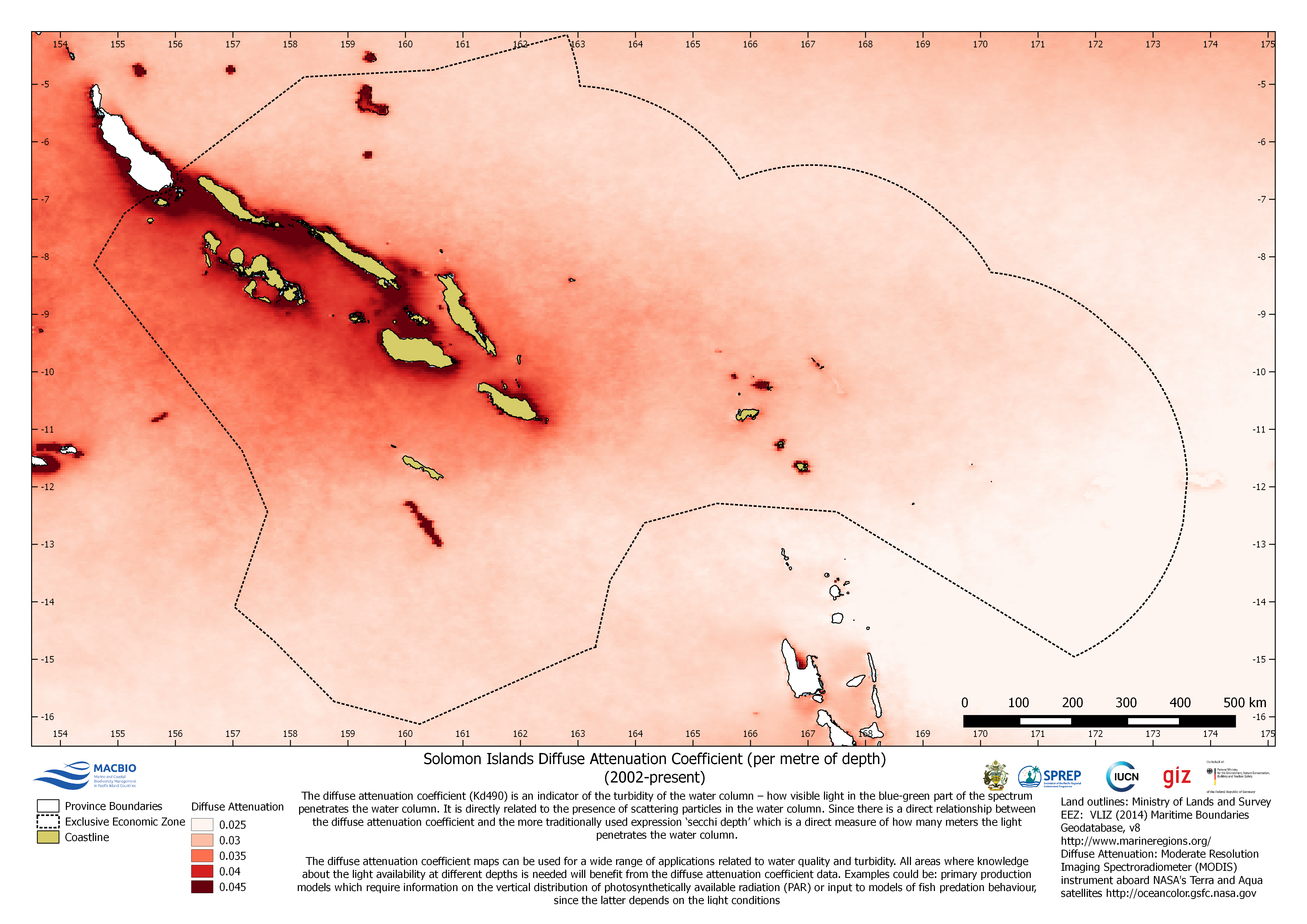
Solomon Islands Diffuse Attenuation Coefficient (per metre of depth) (2002-present)
The map shows the diffuse attenuation coefficient (Kd490) which is an indicator of the turbidity of the water column. The grid is derived from MODIS (Moderate Resolution Imaging Spectoradiometer) images from NASA's Terra and Aqua satellites (http://oceancolor.gsfc.nasa.gov).
SI_DA_EEZ.png
(1.07 MB)
Additonal Information
| Field | Value |
|---|---|
| mimetype | image/png |
| filesize | 1.07 MB |
| timestamp | Tue, 06/08/2021 - 05:06 |