Primary tabs
Solomon Islands Competing Marine Resource Uses
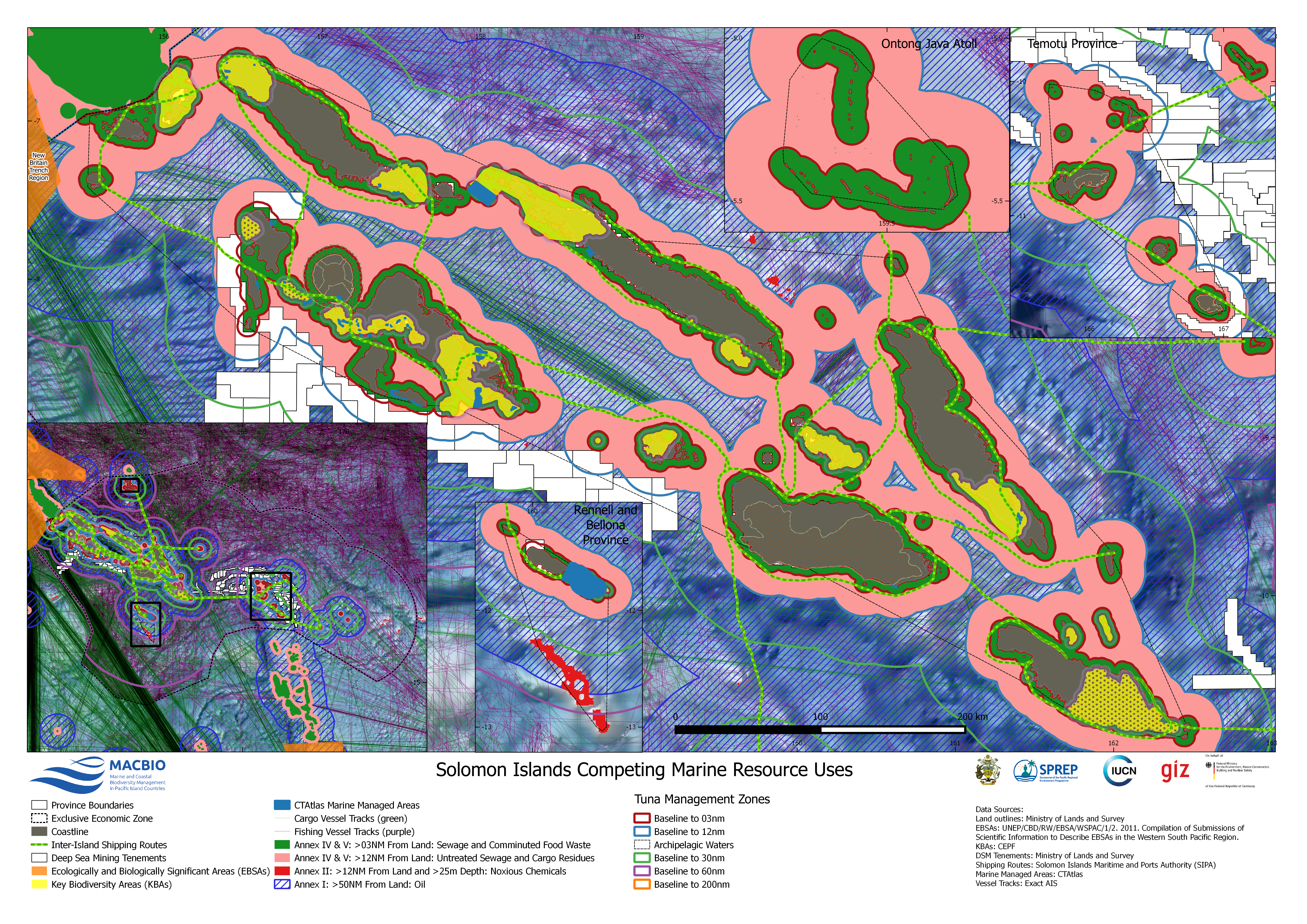
Map showing the different uses that put pressure on the marine environment. This includes among others vessel tracts, fisheries data, protected and restricted areas. Data sources are:
UNEP/CBD/EBSA/WSPAC/1/2. 2011. Compilation of Scientific Information to Describe EBSAs in the Western South Pacific Region.
KBAs: CEPF
DSM Tenements: Ministry of Lands and Survey, Solomon Islands
Shipping Routes: Solomon Islands Maritime and Ports Authority (SIPA)
Marine Managed Areas: CTAtlas
Vessel Tracks: Exact AIS
SI_Competing_Resource_Uses.png
(29.56 MB)
Additonal Information
| Field | Value |
|---|---|
| mimetype | image/png |
| filesize | 29.56 MB |
| timestamp | Tue, 06/08/2021 - 05:06 |
| Source URL | http://macbio-pacific.info/ |