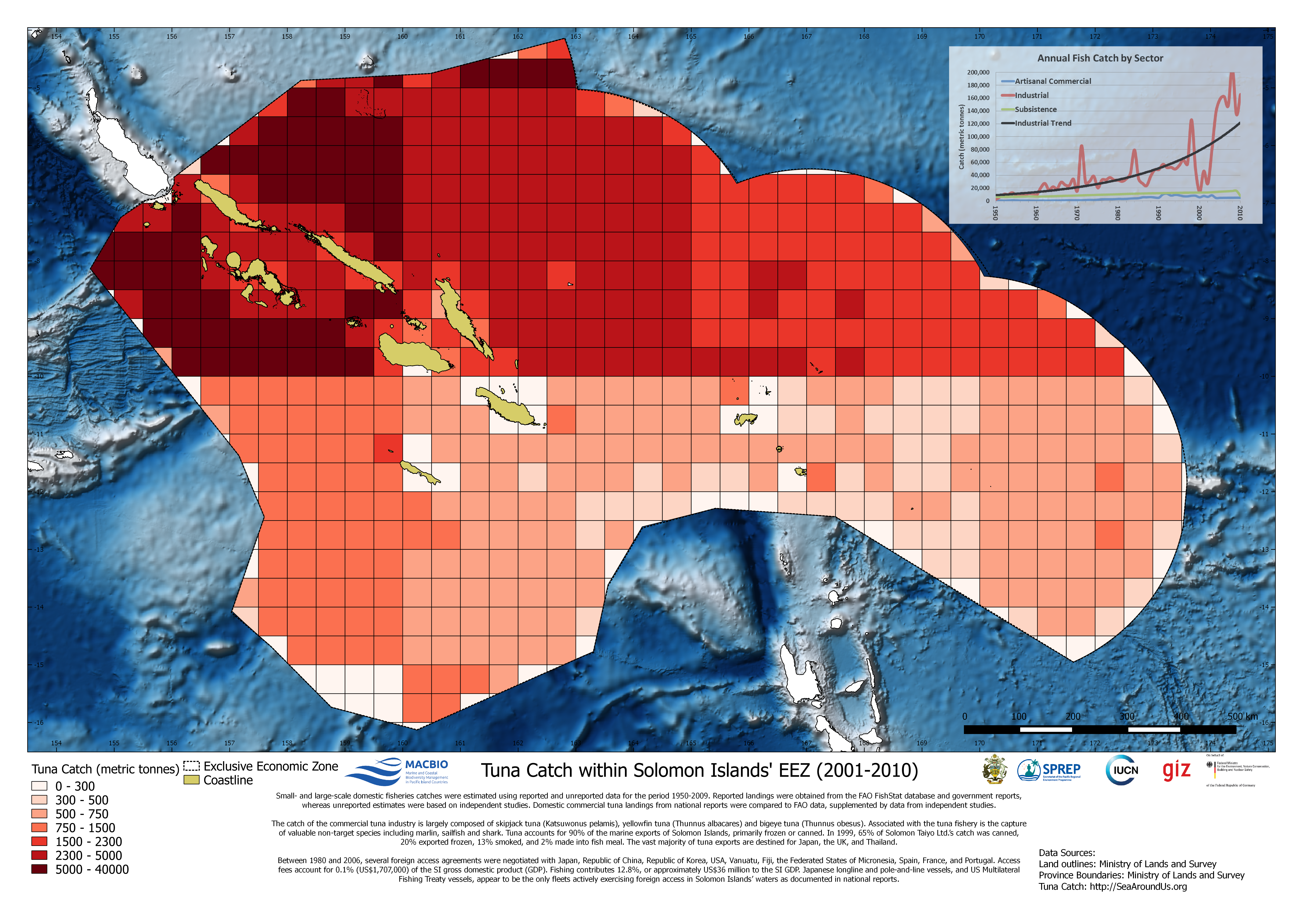
Map showing tuna catch in metric tonnes of…

To provide an enabling environment for the socio-economic development of the Solomon Islands through the application of necessary safeguards with regard to:sustainable use of natural resources, the provision of meteorological services, reducing the risk and impact of climate change and other hazards to communities, leading and managing disaster preparedness and their consequences.
The MECDM has 4 Divisions and 1 Office which include: Climate Change Division (CCD), Corporate Services Division, Environment & Conservation Division (ECD), Meteorological Services Division, National Disaster Management Office (NDMO)
License
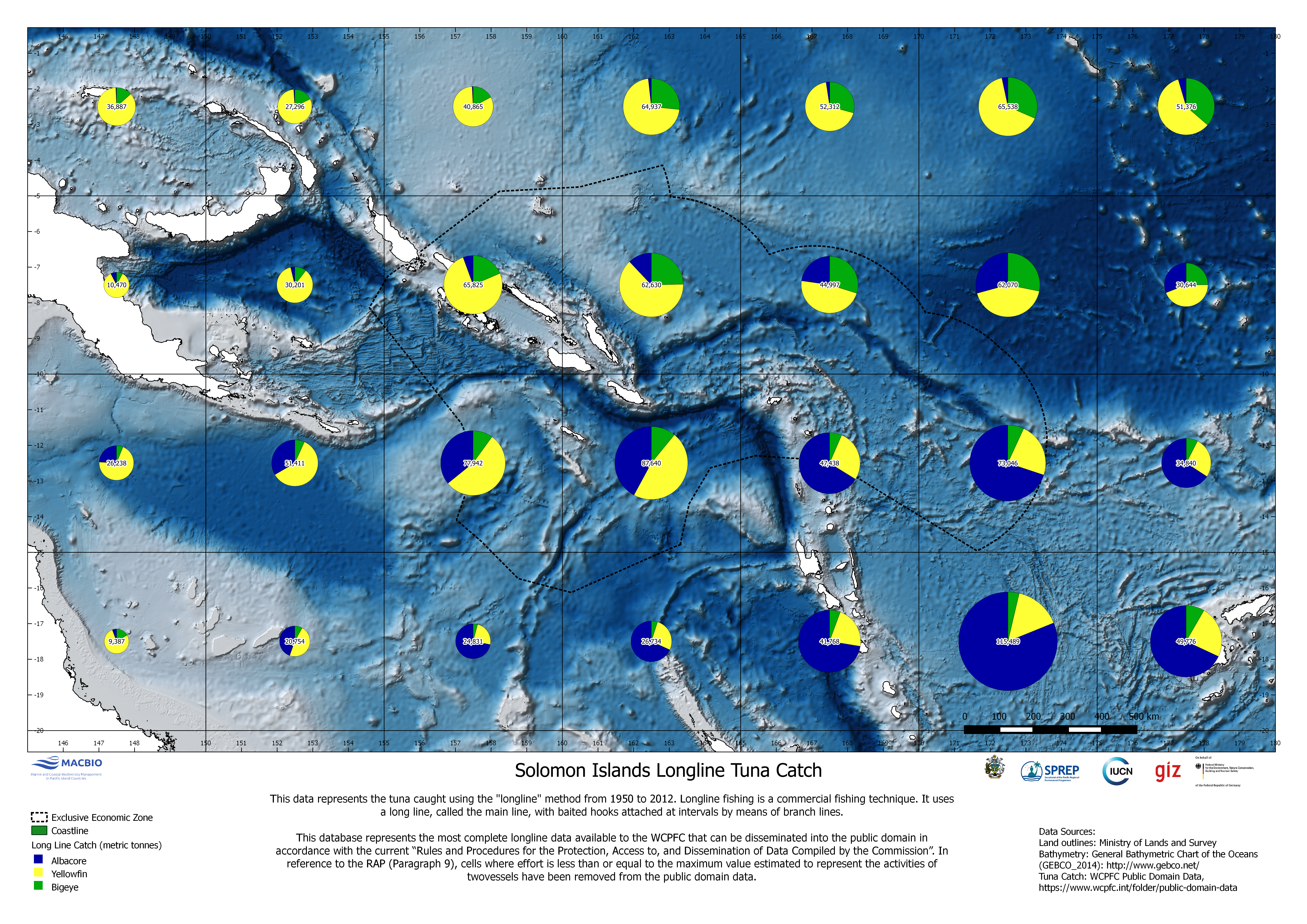
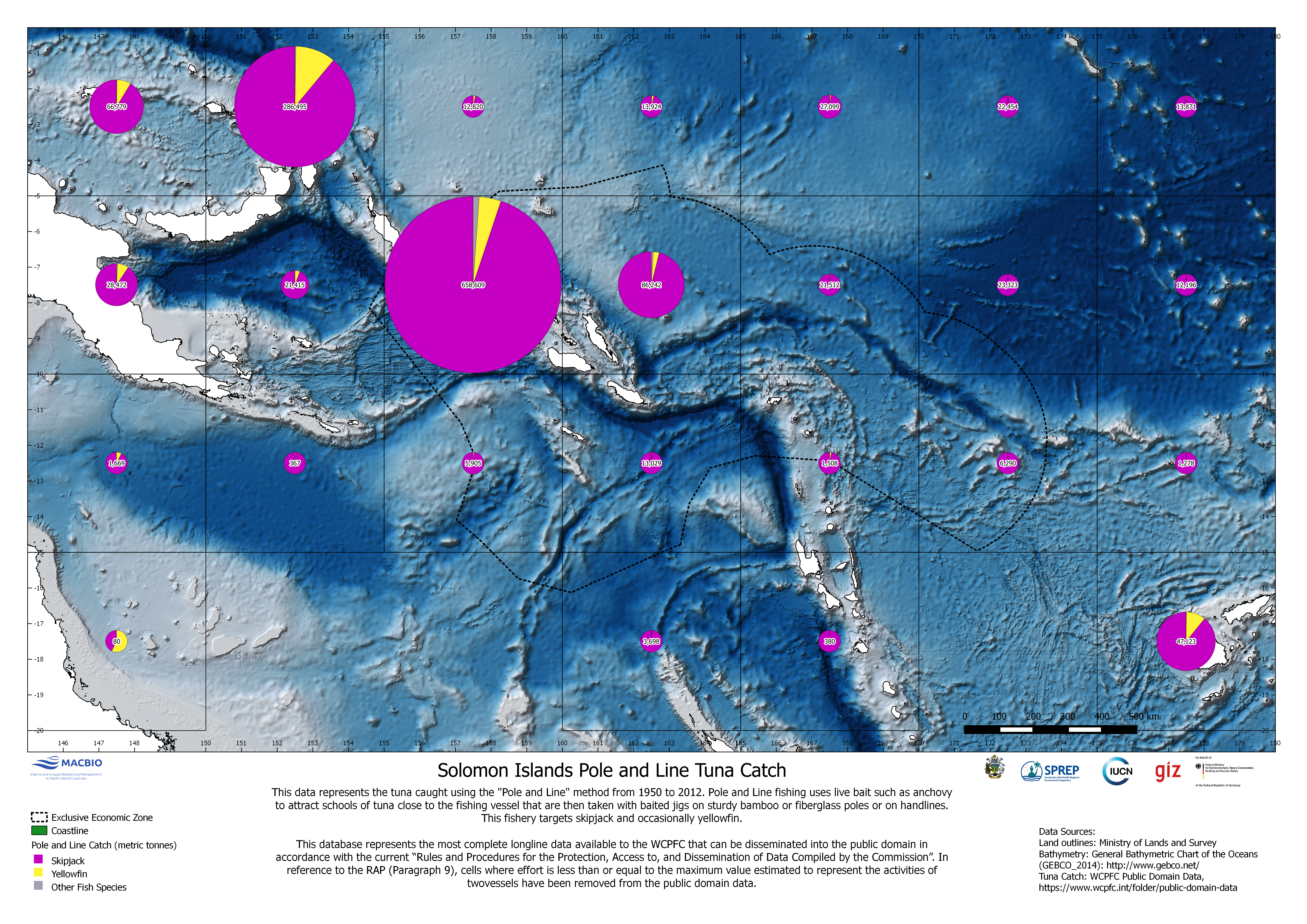
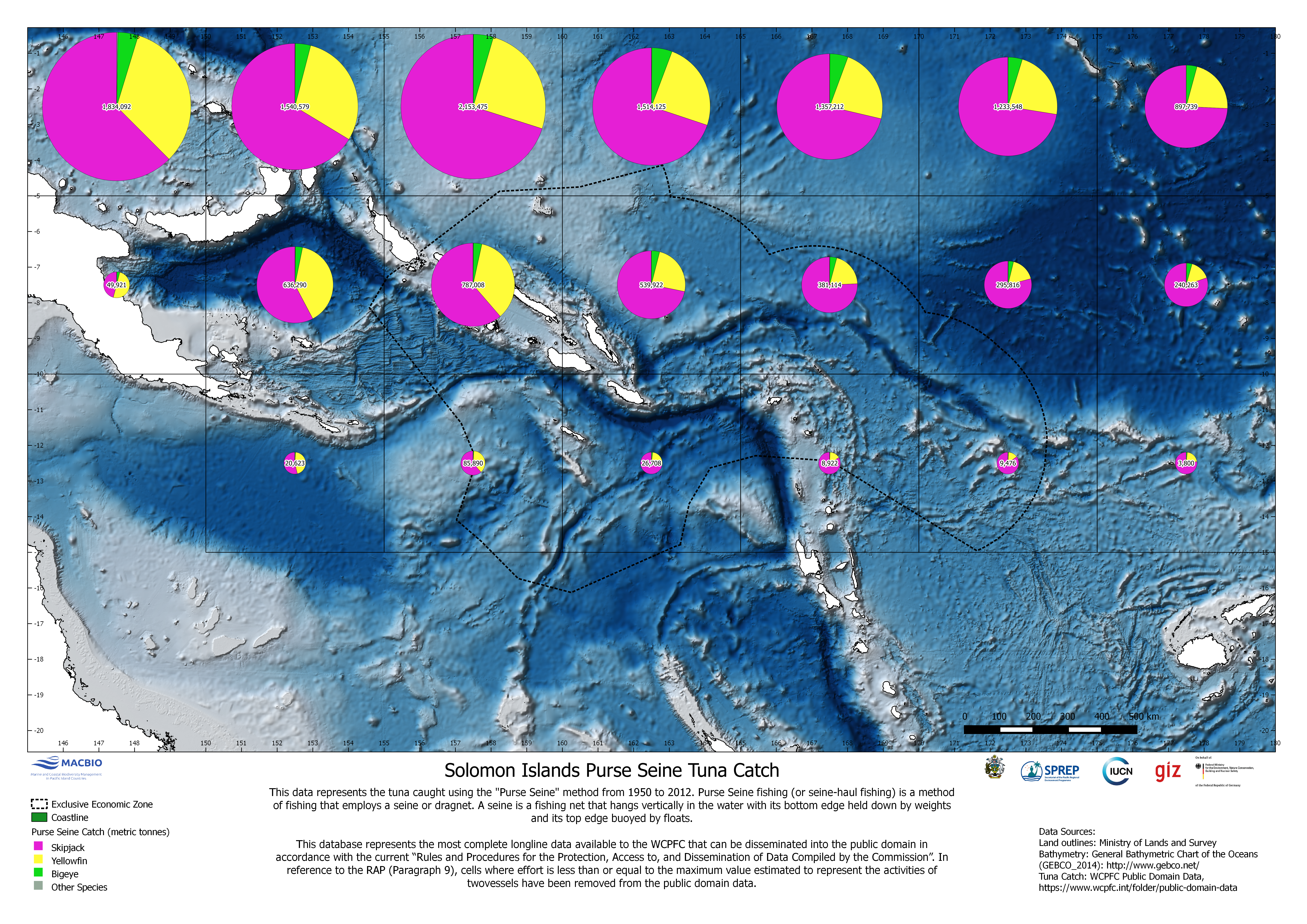
Maps showing different aspects of tuna catch data within Solomon Islands EEZ. Maps were developed by MACBIO as resource for the bioregions workshop in Feb 2018.
Data and Resource
| Field | Value |
|---|---|
| Publisher | Solomon Islands Ministry of Environment, Climate Change, Disaster Management and Meteorology |
| Modified | |
| Release Date | |
| Identifier | 2fd3d802-74ee-4ce7-bf0f-734cea7e4a28 |
| Spatial / Geographical Coverage Location | Solomon Islands |
| Relevant Countries | Solomon Islands |
| Language | English (Australia) |
| License |
Public
![[Open Data]](https://assets.okfn.org/images/ok_buttons/od_80x15_blue.png)
|
| Author | MACBIO |
| Contact Name | Anja Nicolay-Grosse Hokamp |
| Contact Email | anja.nicolay-grosse@giz.de |